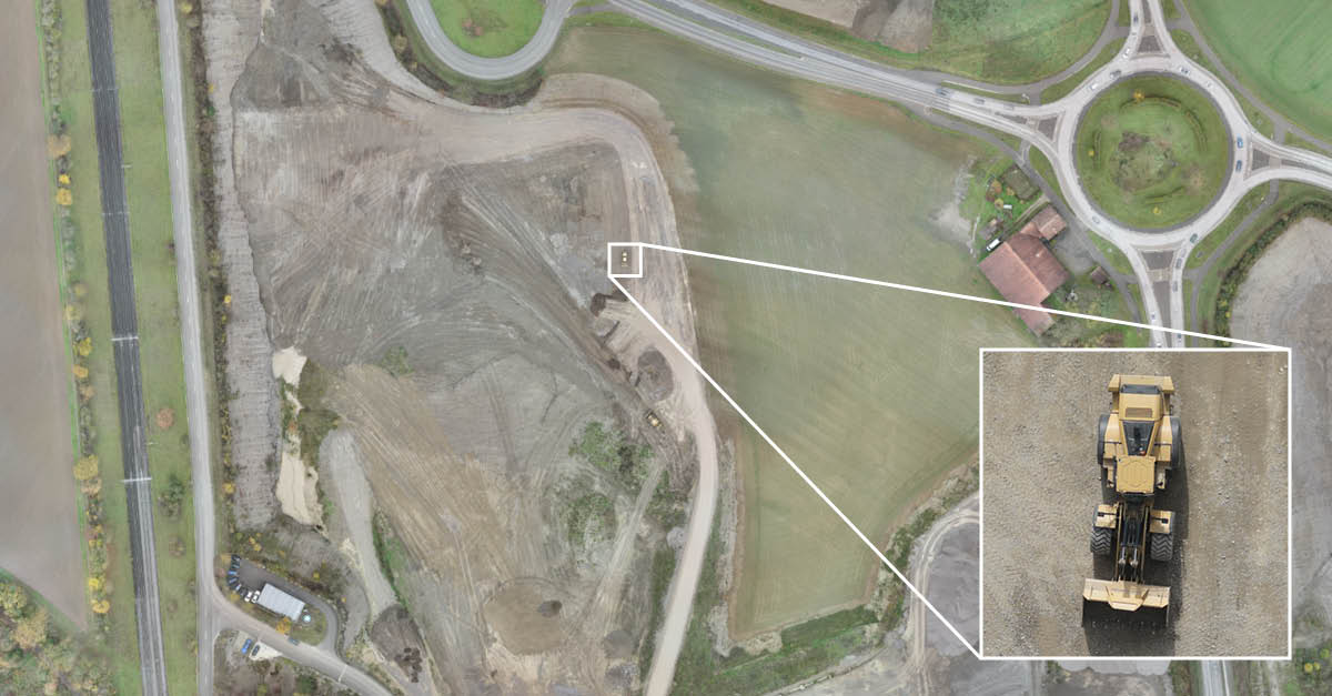
In a recent flight, our team shows how surveyors can achieve an area coverage of 130 ha at GSD lower than 1 cm.
When it comes to the world of drone photogrammetry, trade-offs abound – something we at Wingtra have been committed to minimizing at every level. We have already discussed how the WingtraOne lets our users have both, the ease-of-use and accuracy of multicopters, and the long range of fixed-wings. In this post, we describe how the WingtraOne bridges the gap between high coverage and low GSDs.
The imperfect world of drones
The trade-off between area coverage and ground sample distance (GSD) has long plagued the commercial drone photogrammetry space. For surveyors, the ability to have large area coverage in a single flight means less time and easier project execution. But to get high accuracy, using low GSD is necessary.
The GSD is the real-world size of a pixel: lower the GSD, higher the resolution of imagery. This needs a combination of high quality sensors and low altitude – both of which reduce coverage. High quality sensors typically tend to be heavier, reducing flight efficiency, thereby reducing the flight range. Moreover, flying at low altitude reduces the field of view of the sensor, resulting in less coverage. How do we bridge this gap?

Finding the sweet spot
To find how high of an area coverage we can extract at low GSDs, we partnered with Andy Gerber of Kies AG to map a quarry near Glattfelden, Switzerland. We chose a relatively flat terrain to eliminate any severe distortions of the average GSD, with the difference in maximum and minimum altitude being 50 m.
At Glattfelden, we configured the WingtraOne with our high accuracy sensor: the Sony RX1RII – a full frame 42 MP camera with a fixed focal length of 35 mm. The required GSD was set to 0.9 cm, which combined with the settings of the camera, yielded the required flight altitude to be 70 m above home. We then set the side overlap of the flight to 60% and forward overlap to 80% to obtain a good quality map at these settings.
Twice the area at nearly double the resolution
After 52 minutes of flying for 48.8 km, we covered an area of 130 ha at an average GSD of 0.93 cm, accounting for slight variations in the terrain. To put this in perspective, the WingtraOne achieved a 40% lower GSD than the industry standard fixed-wing solutions, where 1.5 cm is the lowest GSD typically offered. Further, even at this higher GSD of 1.5 cm, fixed-wing solutions can only cover an area little more than half of what we achieved with the WingtraOne. On the other hand, Multicopter solutions when operating at a 0.9 cm GSD setting, barely cover 20 ha in a single flight of 35 minutes.

What next? For one, investigating the coverage at the lowest possible GSD with WingtraOne – that of 0.7 cm, would certainly be interesting. Secondly, how does the low GSD result in high accuracy?
P.S. find the project data samples and the map here.


