- Urban planning and land management
- Land surveying, Topographic surveys
- Oblique Sony a6100
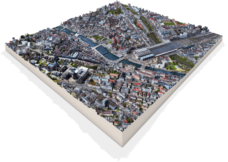
Wingtra creates stunning digital twin of Zurich
As Wingtra just launched its next-generation GEN II commercial mapping drone with a new Oblique Sony a6100 payload option, the engineering team sought to test it out. What better way than to map the city of Zurich?
Wingtra’s mapping specialist Andrea Nater went out and flew 800 ha (1980 ac) of the city center at a GSD of 3.1 cm (1.2 in) in just 6 flight hours. To cover this area this fast in this setting would have been impossible with any other drone, she suspects.
“Desktop planning was quite helpful before setting out, and in the city it was easy to adjust the plans on the tablet,” she added.
The results, processed by Bentley Context Capture, were quite impressive. Plus, the amount of data captured was still relatively lean.
“The GEN II oblique option is really different than other payloads,” Nater explained, “because you don’t have to fly a cross-grid and can capture in one shot what other systems might need five to achieve.”
In the end, such detailed 3D data is essential to any city on the path to digital transformation. It allows city officials, urban planners, engineers and architects to design urban environments with better quality of life, and to plan and monitor critical infrastructure as well as simulate the effect of environmental changes.


